Genealogy Orienteering: Using Maps to Find the RIGHT Place

George G. Morgan
Feb 20, 2026
95 views
CC
Free
Free through February 27, 2026
Want to watch the full webinar?
Join now to access all 2,658 webinars and unlock all features.

Content

Play. Playing.
Introduction
4m 50s
Play. Playing.
Methodology That Works
9m 20s
Play. Playing.
What if You can't Find It?
4m 01s
Play. Playing.
Map Guide to US Census
7m 59s
Play. Playing.
Resources
9m 55s
Play. Playing.
If You Plan to Visit
4m 02s

About this webinar

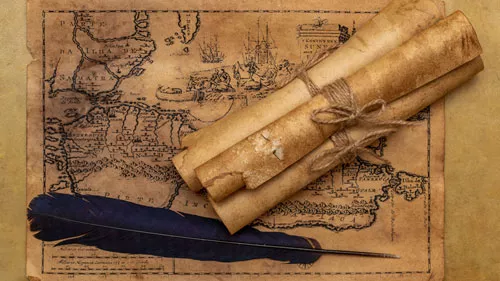
This genealogical video presents a methodology for using current and historical maps, gazetteers, and other tools to help you always find the evidence you seek.

About the speaker

About the speaker

George G. Morgan is the president of Aha! Seminars, Inc.(R) and an internationally recognized genealogy presenter. He is the co-host of the longest-running genealogical podcast, The Genealogy Guys Podcast,
Learn more...

Key points and insights

In the complex world of family history, the most frequent research errors often stem from looking in the wrong location for the right people. This presentation, “Genealogy Orienteering: Using Maps to Find the Right Place,” introduces a systematic methodology for navigating the shifting geopolitical landscapes of the past. By treating genealogical research like the sport of orienteering—using maps and specific tools to cross unfamiliar terrain—researchers can pinpoint the exact jurisdictions responsible for record-keeping at any given moment in history. Understanding how boundaries moved and names changed is not just a geographical exercise; it is the essential foundation for discovering the births, marriages, and land transactions that define an ancestor’s life.

  • The Contemporary-to-Historical Workflow: Effective research begins with identifying an ancestor’s location on a modern map to establish a baseline, then layering historical maps and gazetteers to trace how that specific coordinate moved through different county or provincial jurisdictions over time.
  • The Power of Spatial Perspective: Using tools like transparent protractors to measure the distance and direction between an ancestor’s home and local landmarks—such as rivers, railroads, or houses of worship—provides a visual context that can explain migration patterns and community involvement.
  • Targeted Repository Outreach: Success in obtaining records depends on contacting the correct governmental entity; by confirming county formation dates and utilizing resources like the Ancestry Red Book, researchers can provide clerks with specific, actionable data that increases the likelihood of a successful search.

Mastering the art of genealogy orienteering ensures that every research trip or inquiry is focused and productive, preventing the wasted effort of spinning the wrong microfilm reels or visiting the wrong courthouses. Viewing the full webinar will provide a deeper understanding of these visual techniques and help dismantle the “brick walls” that often arise from geographical confusion. For those ready to sharpen their navigational skills, the accompanying syllabus contains a wealth of useful links, including historical map collections and place-name dictionaries, to guide the next phase of the journey.

Comments

Your email address will not be published. Required fields are marked *

1000 characters remaining

Sort by Newest
Sort by Close.
  • Newest
  • Oldest
  • Likes

Related Webinars